
Iceland F-roads
F910 Austurleið / Askja approach (east)
Closed Road notes by Nimrod Ron · Iceland Lead & Content Curator· Updated
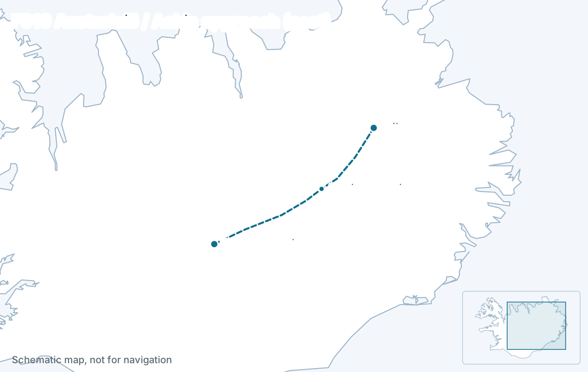
F910 Austurleið is two very different roads. Its eastern part, reached from Route 901 and F905 near Möðrudalur, is the gentler self-drive approach to Askja with predictable small streams. Its western part, Gæsavatnaleið along the north side of Vatnajökull to Sprengisandur, crosses massive glacial meltwater rivers and quicksand and is for modified super-jeeps in convoy. It opens in July and closes in September.
Key facts
- Connects
- East: Möðrudalur (Route 901, F905) to Drekagil. West: Drekagil along Vatnajökull to F26 Sprengisandur
- Length
- 160 km, about East section 2 to 3 hours; west section a full day in convoy in good conditions
- Opens
- July
- Closes
- September
- Rivers
- Yes. Water tier 4: large and unpredictable water crossings
- Car
- Modified super jeep, a highland bus or a tour; not a rental 4x4
- Region
- Northeast / East Highlands
Status today
Closed
- Sprengisandsleið – HoluhraunClosed
- Möðrudalsleið – Jökuldalsv. (Þríh.leið)Closed
- Upphéraðsvegur – SnæfellsleiðClosed
- Snæfellsleið – KárahnjúkarClosed
- VikursandurClosed
- Öskjuleið – KverkfjallaleiðClosed
- Kárahnjúkar – ÞríhyrningsleiðClosed
- Kverkfjallaleið – KreppaClosed
Source: umferdin.is (Icelandic Road and Coastal Administration), as of 29 Oct 2026, 08:46. Re-check road.is on the morning you drive.
The facts
| Fact | Value |
|---|---|
| Connects | East: Möðrudalur (Route 901, F905) to Drekagil. West: Drekagil along Vatnajökull to F26 Sprengisandur |
| Region | Northeast / East Highlands |
| Length of the F-road section | about 160 km |
| Driving time | East section 2 to 3 hours; west section a full day in convoy |
| Status now | Closed |
| Typical opening | July |
| Typical closing | September |
| Difficulty | extreme |
| 4x4 required | Yes, by law |
| River crossings | Yes · water tier 4 |
| Car that fits | Modified super-jeeps only — 35-inch+ tyres, snorkel, and an experienced driver. |
Reaches: Möðrudalur farm · Drekagil and Askja · Holuhraun lava field (2014 eruption) · Gæsavötn and Tungnafellsjökull (west)
The road
From the Ring Road near Möðrudalur, Route 901 and F905 lead south to F910, which runs across the sands to the Drekagil hut below Askja. Beyond Dreki the western F910 continues past the Holuhraun lava field from the 2014 eruption and along the northern edge of Vatnajökull to the Gæsavötn lakes and Sprengisandur: the most remote drive in the country.
River crossings and the car
East section: second water tier, small to medium streams a standard 4x4 handles in normal summer conditions. West section: fourth tier, unmanaged glacial rivers and quicksand, modified super-jeeps only and never alone. Rental contracts that allow F910 east still exclude the Gæsavatnaleið.
Water tier 4: Large and unpredictable water crossings. Modified super-jeeps only — 35-inch+ tyres, snorkel, and an experienced driver.
When it opens
July, among the last roads to open, and it closes in September. The western part is sometimes not opened at all in a wet year. Recorded dates are below.
| Year | First day open | Last day open | Days open | Days sampled |
|---|---|---|---|---|
| 2026 | not yet | – | 0 | 11 |
Download the data (CSV) · free to reuse under CC BY 4.0 with a link back.
How itineraries use it
The eastern section is the self-drive way into Askja for plans with a standard 4x4 and a night at Möðrudalur or Dreki. The western section appears only in expedition-style trips with a guide or a convoy of super-jeeps.
Itineraries that use F910
Editor-picked Highlands plans from real trips drive this road or reach the places on it. Duplicate one and make it yours.
See itineraries with F910Questions about F910
Is F910 the easy way to Askja?
The eastern part is: from Möðrudalur via Route 901 and F905, with small, predictable streams a standard 4x4 handles in summer. Do not confuse it with the western F910 along Vatnajökull, which is super-jeep only.
Can I drive F910 west to Sprengisandur?
Only in a modified super-jeep with a second vehicle and an experienced driver. The Gæsavatnaleið crosses large glacial rivers with quicksand on the approach to Nýidalur, and every rental contract excludes it. The eastern F910 from Möðrudalur to Askja is a different road, and the one a high-clearance rental 4x4 can drive.
When does F910 open?
Usually in July, closing in September; the western part toward Sprengisandur may stay closed in a wet year. Askja itself is reached on the eastern section via F905 and F910 from Möðrudalur. Check the live status above and road.is; the Dreki rangers post the state of the Lindaá and the other fords each morning in season.
Read next
Deeper reading on iceland-trip.com
Our sister site covers every place in depth: access, parking, seasons, what to expect. Written by the same team.
 Askja CalderaDiscover Askja Caldera: How to reach Viti crater, plus hiking tips, photography advice, and top places to stay.iceland-trip.com · Highlands
- Renting a car and driving in IcelandWhich car to rent, the insurance that matters, gravel and F-road rules, fuel, speed limits and the mistakes that cost visitors money.iceland-trip.com
 Stuðlagil CanyonPlanning a visit to Stuðlagil Canyon? Learn where to park, which side to choose, what the hike is like, and when to see the canyon at its best.iceland-trip.com · East Iceland