
Iceland F-roads
F35 Kjalvegur (Kjölur route)
Partly open Road notes by Nimrod Ron · Iceland Lead & Content Curator· Updated
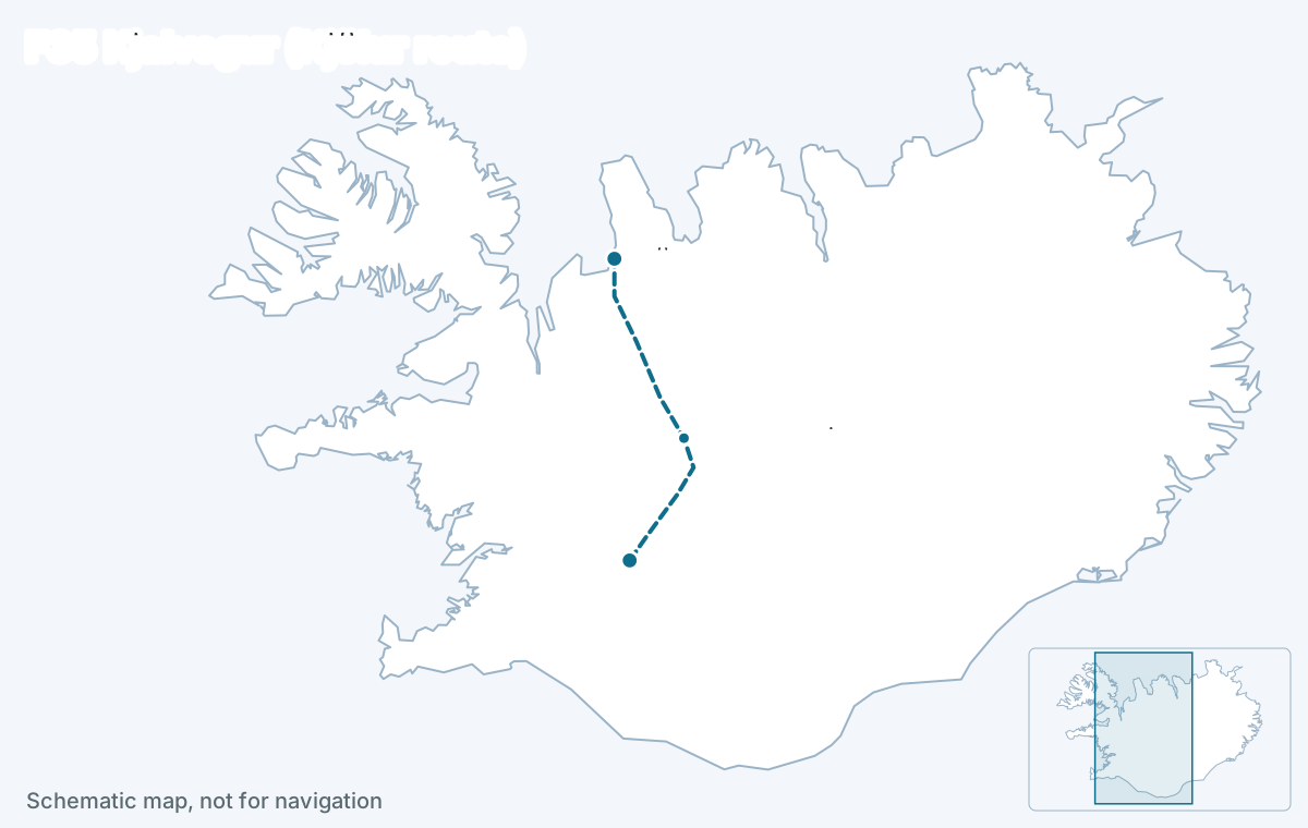
F35, the Kjölur route (Kjalvegur), is the easiest way across Iceland’s Highlands: about 165 km of gravel between Gullfoss and the Ring Road near Blönduós with every major river bridged. Any 4x4 that the rental contract allows on F-roads can drive it, it is usually the first big F-road to open in early to mid-June, and it reaches Hveravellir hot springs and the Kerlingarfjöll geothermal mountains on the way.
Key facts
- Connects
- Gullfoss (Golden Circle) to Route 1 near Blönduós, North Iceland
- Length
- 165 km, about 4 to 5 hours without stops in good conditions
- Opens
- early to mid-June
- Closes
- late September to mid-October
- Rivers
- None (bridged or dry)
- Car
- 4x4 required by law; a standard 4x4 SUV is enough
- Region
- Central Highlands
Status today
Partially open — some sections passable, others closed
- Svínvetningabraut – BlönduvirkjunOpen
- Þjófadalavegur – BlönduvirkjunClosed
- Hagavatnsvegur – BláfellshálsClosed
- Kerlingarfjallavegur – ÞjófadalavegurClosed
- Gullfoss – HagavatnsvegurClosed
- Hagavatnsvegur – BláfellshálsClosed
- Bláfellsháls – KerlingarfjallavegurClosed
- Kerlingarfjallavegur – ÞjófadalavegurClosed
Source: umferdin.is (Icelandic Road and Coastal Administration), as of 29 Oct 2026, 09:51. Re-check road.is on the morning you drive.
The facts
| Fact | Value |
|---|---|
| Connects | Gullfoss (Golden Circle) to Route 1 near Blönduós, North Iceland |
| Region | Central Highlands |
| Length of the F-road section | about 165 km |
| Driving time | 4 to 5 hours without stops |
| Status now | Partially open — some sections passable, others closed |
| Typical opening | early to mid-June |
| Typical closing | late September to mid-October |
| Difficulty | easy |
| 4x4 required | Yes, by law |
| River crossings | None |
| Car that fits | Any 4x4, even a compact one (Dacia Duster, Suzuki Jimny). |
Reaches: Hvítárvatn and Langjökull views · Kerlingarfjöll (via F347) · Hveravellir hot springs · Blöndulón reservoir
The road
Kjölur runs north from Gullfoss through the pass between the Langjökull and Hofsjökull ice caps and comes out on Route 1 west of Blönduós. The surface is graded gravel with long washboard stretches and some loose sections, and it climbs to about 700 m, so wind and fog are the hazards rather than water. It is the one highland crossing most travelers can add to a Ring Road loop with a standard 4x4.
Fuel is only at either end. Fill up at Geysir or Flúðir going north and at Blönduós going south; the Hveravellir and Kerlingarfjöll huts sell food but not fuel.
River crossings and the car
The rivers on Kjölur itself are bridged. Rental companies that permit F-roads at all permit F35 in a compact 4x4 such as a Dacia Duster or Suzuki Jimny. A 2WD is illegal on it and uninsured. The short spur to Kerlingarfjöll (F347) has minor streams; the spur to Hveravellir is gravel with no ford.
Water tier 1: No water crossings — suitable for all 4x4s. Any 4x4, even a compact one (Dacia Duster, Suzuki Jimny).
When it opens
Because it has no fords to wait for, Kjölur is usually among the first major F-roads the road authority opens, in early to mid-June, and it closes with the first lasting snow between late September and mid-October. A heavy winter pushes the opening two to three weeks later. The table below shows the dates recorded each year.
| Year | First day open | Last day open | Days open | Days sampled |
|---|---|---|---|---|
| 2026 | 19 Oct 2026 | 29 Oct 2026 | 9 | 11 |
Download the data (CSV) · free to reuse under CC BY 4.0 with a link back.
How itineraries use it
As a one-day highland crossing between the Golden Circle and the north, replacing the western leg of the Ring Road: Geysir or Gullfoss in the morning, Hveravellir for a soak, a night at Kerlingarfjöll or in the north. Plans with 14 days or more use it to add the interior without a Superjeep.
Itineraries that use F35
Editor-picked Highlands plans from real trips drive this road or reach the places on it. Duplicate one and make it yours.
See itineraries with F35Questions about F35
Can I drive F35 Kjölur in a Dacia Duster?
Yes, in summer when it is open. F35 has bridged rivers and is approved for compact 4x4s by most rental companies that allow F-roads at all. Check that your contract lists F-roads as permitted; a 2WD is illegal on any F-road.
How long does it take to drive Kjölur?
About four to five hours of driving for the 165 km of gravel between Gullfoss and Blönduós, before stops. With Hveravellir and the Kerlingarfjöll spur it is a full day; many travelers overnight at Kerlingarfjöll Highland Base or Hveravellir.
When does F35 open?
Usually in early to mid-June, often the first big F-road to open, and it closes between late September and mid-October. Check the live status above and road.is on the morning you drive; the dates shift by weeks from year to year.
Is there fuel on Kjölur?
No. Fill up at Geysir or Flúðir in the south or Blönduós in the north before the crossing; the route is about 200 km of gravel with nothing in between. The huts at Hveravellir and Kerlingarfjöll have food and lodging but no fuel. A 4x4 on gravel uses noticeably more than on the Ring Road, so start full.
Read next
Deeper reading on iceland-trip.com
Our sister site covers every place in depth: access, parking, seasons, what to expect. Written by the same team.
- Renting a car and driving in IcelandWhich car to rent, the insurance that matters, gravel and F-road rules, fuel, speed limits and the mistakes that cost visitors money.iceland-trip.com
 Hveravellir Hot Springs ReservePlan a visit to Hveravellir hot springs in Iceland’s Highlands, with Route 35 access advice, pool fees, short walks, hiking trails and places to stay.iceland-trip.com · Highlands
 Kerlingarfjöll: Hveradalir Hikes, Roads & Where to StayPlan your Kerlingarfjöll visit with Hveradalir hiking options, Route 35 and F347 access, summer and winter travel advice, and practical accommodation choices.iceland-trip.com · Golden Circle
- The HighlandsLandmannalaugar, Þórsmörk, Askja and the F-roads that reach them.iceland-trip.com