
Iceland F-roads
F249 Þórsmörk road (Þórsmerkurvegur)
Partly open Road notes by Nimrod Ron · Iceland Lead & Content Curator· Updated
F249 Þórsmerkurvegur is the 30 km road into Þórsmörk from Route 1 near Seljalandsfoss, under the Eyjafjallajökull ice cap past Gígjökull and the Stakkholtsgjá canyon. It is the most-driven and most-misjudged F-road in Iceland: a high-clearance 4x4 can reach Básar in settled weather, but the Krossá, the glacial river before the Þórsmörk huts, is for modified super-jeeps only and no rental insurance covers water. It opens in June and most travelers go by the highland bus or a Superjeep tour.
Key facts
- Connects
- Route 1 at Seljalandsfoss (via Route 249) to Básar and Þórsmörk
- Length
- 30 km, about 1.5 to 2 hours each way, more at the fords in good conditions
- Opens
- June (highly weather-dependent)
- Closes
- September to October
- Rivers
- Yes. Water tier 4: large and unpredictable water crossings
- Car
- Modified super jeep, a highland bus or a tour; not a rental 4x4
- Region
- South (off Route 1 near Seljalandsfoss)
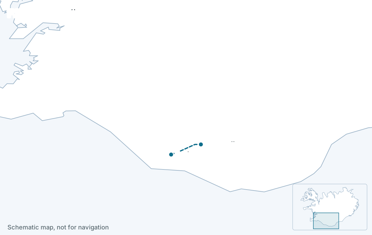
Status today
Partially open — some sections passable, others closed
- Stóra-Mörk – NauthúsagilClosed
- að SeljalandsfossiOpen
- Seljalandsfoss – MerkurvegurClosed
- Merkurvegur – Stóra-MörkClosed
- Nauthúsagil – JökultungurClosed
- Jökultungur – BásarClosed
Source: umferdin.is (Icelandic Road and Coastal Administration), as of 29 Oct 2026, 09:51. Re-check road.is on the morning you drive.
The facts
| Fact | Value |
|---|---|
| Connects | Route 1 at Seljalandsfoss (via Route 249) to Básar and Þórsmörk |
| Region | South (off Route 1 near Seljalandsfoss) |
| Length of the F-road section | about 30 km |
| Driving time | 1.5 to 2 hours each way, more at the fords |
| Status now | Partially open — some sections passable, others closed |
| Typical opening | June (highly weather-dependent) |
| Typical closing | September to October |
| Difficulty | extreme |
| 4x4 required | Yes, by law |
| River crossings | Yes · water tier 4 |
| Car that fits | Modified super-jeeps only — 35-inch+ tyres, snorkel, and an experienced driver. |
Reaches: Seljalandsfoss and Gljúfrabúi at the junction · Gígjökull glacier tongue · Stakkholtsgjá canyon · Básar, Langidalur and the Valahnúkur hike
The road
Route 249 leaves the Ring Road at Seljalandsfoss as gravel and becomes F249 a few kilometres in. It follows the Markarfljót valley with Eyjafjallajökull above, passes the lagoon at Gígjökull where the 2010 eruption flooded through, and the Stakkholtsgjá canyon walk, then reaches the Básar huts. The Krossá, braided across the valley floor between Básar and Langidalur, is the barrier: it shifts, deepens and runs grey with glacial silt, and it drowns cars every summer.
River crossings and the car
As far as Básar: third tier, a high-clearance 4x4 with experience and settled weather, with smaller fords on the way that still exceed a compact 4x4 after rain. The Krossá: fourth tier, modified super-jeeps with 35-inch tyres and snorkels only. Rental contracts commonly exclude F249 entirely, and water damage is never insured.
Water tier 4: Large and unpredictable water crossings. Modified super-jeeps only — 35-inch+ tyres, snorkel, and an experienced driver.
When it opens
June, but it is the most weather-dependent of the popular routes and is closed by rain and melt inside the season; it closes for good between September and October. The recorded dates are below. The highland buses run on a published summer timetable whatever the road status.
| Year | First day open | Last day open | Days open | Days sampled |
|---|---|---|---|---|
| 2026 | 19 Oct 2026 | 29 Oct 2026 | 10 | 11 |
Download the data (CSV) · free to reuse under CC BY 4.0 with a link back.
How itineraries use it
As a day in Þórsmörk from Hella, Hvolsvöllur or Vík by Superjeep tour or the highland bus, with the Valahnúkur viewpoint hike and Stakkholtsgjá, and the car left at the Seljalandsfoss car park. Self-drive plans in the catalog stop at Stakkholtsgjá or Gígjökull with a capable car and do not attempt the Krossá.
Itineraries that use F249
Editor-picked Highlands plans from real trips drive this road or reach the places on it. Duplicate one and make it yours.
See itineraries with F249Questions about F249
Can I drive to Þórsmörk in a rental 4x4?
To Básar, in settled weather, with a high-clearance 4x4 that the contract allows on F249, and even then the fords on the way exceed a compact 4x4 after rain. Beyond Básar the Krossá is super-jeep only. Most travelers take the highland bus or a tour and avoid the risk.
How do I get to Þórsmörk without crossing rivers?
The highland bus from Reykjavík, Hella and Hvolsvöllur in summer, or a Superjeep day tour. Both cross the rivers in vehicles built for them. You can also drive the paved road to Seljalandsfoss and join the bus there.
Can I see anything on F249 with a normal 4x4?
The first part to Gígjökull and the Stakkholtsgjá canyon walk is reachable with a high-clearance 4x4 in dry conditions, and both are worth the drive. Stop there; the fords get worse the deeper you go.
When is F249 open?
From June until September or October, with closures inside the season after rain or a warm spell that swells the Krossá. Check the live status above and road.is on the morning you go; the highland bus runs to Þórsmörk whenever the road is open and is the way in without a modified 4x4. Recorded dates by year are below.
Read next
Deeper reading on iceland-trip.com
Our sister site covers every place in depth: access, parking, seasons, what to expect. Written by the same team.
 Thorsmork Travel GuidePlan a safe visit to Þórsmörk in South Iceland, including 4x4 vehicle access, river warnings, summer buses, Super Jeep tours and the best hikes.iceland-trip.com · Highlands
- Renting a car and driving in IcelandWhich car to rent, the insurance that matters, gravel and F-road rules, fuel, speed limits and the mistakes that cost visitors money.iceland-trip.com
- The HighlandsLandmannalaugar, Þórsmörk, Askja and the F-roads that reach them.iceland-trip.com